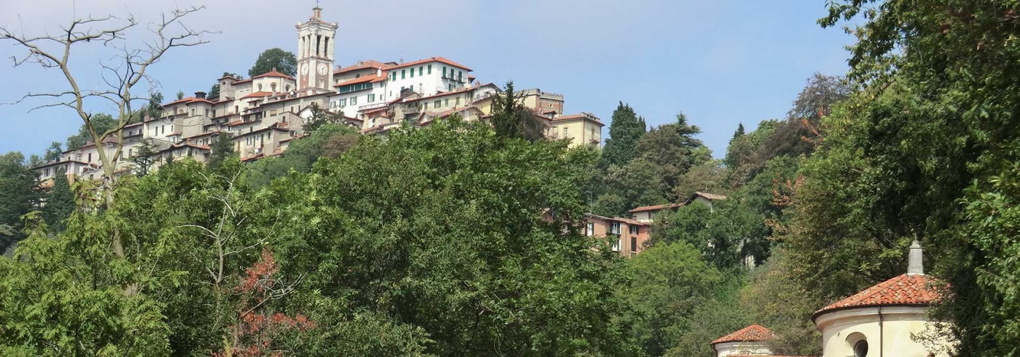
A couple of hundred yards from the start of the No. 3 trail is the village of Santa Maria del Monte, where we can visit the famous Sanctuary of the Blessed Virgin and the neighbouring Convent of the Romite Ambrosiane Nuns (a secluded order of Ambrosian nuns), which were both built in the fifteenth century. Next to the sanctuary and convent are the Baroffio-Dell’Aglio Museum and the Pogliaghi Museum, which are packed with art, history and archaeological finds, and the Ceppo spring, which is a natural monument.
The No. 3 trail starts at the north end of the large Piazzale Pogliaghi, which has a car park and stops for public transport. At the north end of Piazzale Pogliaghi we head off following Via Monte Tre Croci, this characterful road is initially tarmacked and later unsurfaced and is one of the most popular walks with visitors to Sacro Monte.
The trail now winds its way along the steep northern slopes of the Campo dei Fiori Regional Park until you reach a rocky spit known as “Sass Scurbatt” at 927 metres (3041 ft). From here you can enjoy beautiful breathtaking views over the valley of Brinzio, Valcuvia, Valtravaglia, the northern part of Lake Maggiore and the soaring mountains beyond.
The trail continues up on high ground until we reach a downhill stretch that leads to a year-round spring known as Fontana Rossa.
The No. 3 trail carries straight on towards the valley floor with the slope becoming gradually less steep as you go. On its way down the slope, after about 550 yards, the trail passes forks on the left and then on the right with the Orino-Brinzio parts of the No. 10 trail which lead to Orino and Brinzio. Continue through Filino until you reach the first houses in Castello Cabiaglio.
Once on the SP 45 (provincial road) you can visit the “Torbiera del Carecc” (Carecc peat bog) nature reserve before you reach the centre of Castello Cabiaglio. If you wish to see the nature reserve, turn left and follow the strada provinciale (provincial road) for a few hundred yards, cross over after the “pro loco” bar and then on to the wide expanse of the peat bog.
The No. 3 trail finishes when it meets the strada provinciale (provincial road). To see the centre of Castello Cabiaglio cross the strada provinciale (provincial road) and go up Via Roma. Castello Cabiaglio is set between the cool green northern slopes of the Campo dei Fiori Regional Park and the southern slope of Monte Martinello.
DETAILS:
- Duration: 3 hours
- Distance: 6 km
- Difficulty: medium
- Altitude: 330 mt.
- Starting point: Santa Maria del Monte dal piazzale Pogliaghi
- Arrival point: Cabiaglio castle
- Parking: yes, free
Complete your journey: reach your destination thanks to Trenitalia