Ganna is the main village in the municipality of Valganna and home to the town hall. It also has Lake Ganna and is probably best known for the imposing compound called the “Abbey of San Gemolo”, which is a monastery/abbey of immense historical and religious importance.
To get to the start of the No. 15 trail, turn off the SS 233 onto the SP 11, which you follow for about 330 yards until you reach the Abbey of San Gemolo. The “Jubilee Trail” also starts from here and winds its way through the Campo dei Fiori Regional Park.
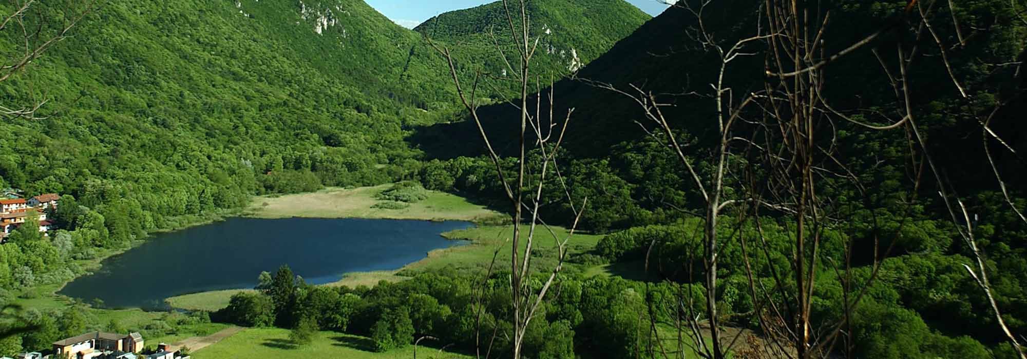
Once past the Abbey, turn left and head off along the first part of our trail along an unsurfaced track that leads to Lake Ganna. Benedictine monks from the abbey dug a drainage channel during the twelfth and thirteenth centuries to link the marshland to Lake Ganna so they could drain some of the water and reclaim land to increase the acreage of their farmland.
The No. 15 trail carries on though to the right and then turns left into a field after twenty of thirty yards. The trail crosses the field until you reach the edge of a wooded area where you find the steep and rather challenging trail that climbs the northern slopes of Monte Martica. This trail climbs at least 330 feet higher and leads to a viewing point that the Campo dei Fiori Regional Park has recently fenced in and installed benches so visitors can sit and admire the Pralugano marshes and Lake Ganna below and also the surrounding mountains and valleys.
Our No. 15 trail continues straight on, taking us to an area called Valicci after a couple of hundred yards. This area also has beautiful, well-managed woods where mostly beech trees grow. This alpine pasture is aptly known by locals as a real “gem set in dappled forests” and has two small groups of pretty traditional chalets as well as a vast expanse of meadow gently sloping to the north-west.
After Valicci we descend a short cobbled slope that takes us to a turning on the right. This turning leads down a path for just over a hundred yards or so to the picnic area, which is a cool, shaded clearing surrounded by centuries-old chestnut trees where the Campo dei Fiori Regional Park has installed wooden benches and tables and some barbecues.
As the main route of the No. 15 trail continues south-west there are several meadows and small flat areas of farmland and a number of quaint chalets on the right towards the top of the hill. Once past the hamlet of “Paurett”, the trail follows a mule track along which a wooden fence has been built to protect people from the extremely steep escarpment that looks out over the Rio Valmolina flowing in the deep valley below.
Continue down a sharp downhill section until you reach a small votive aedicule dedicated to the Virgin Mary where we meet an equally steep cobbled road called Via Sasselli, which is the final stretch of the alternative route from the picnic area. Go left down the hill and past a characterful inn called “Ur Grupp”. Continue over the stone bridge over the Rio Valmolina, and follow the road into the village of Brinzio.
The tiny picturesque village of Brinzio is nestled in a charming, alpine basin between the northern slopes of Campo dei Fiori and Monte Martica. Surrounded by dense shady woodland, it has a pretty lakelet, also called Brinzio, and an ancient traditional village centre featuring old courtyards and narrow lanes all paved with hand-chiselled local red stone. Well worth a visit are the parish church, which is dedicated to Saints Peter and Paul, and the Chapel of Our Lady of Sorrows. It is also home to the headquarters of the Campo dei Fiori Regional Park.
Next we follow the final section of our trail and head off along Via Trieste, a traditional cobbled road. This takes us to the highest and oldest part of the village, a neighbourhood called “Casèè”. The name “Casèè” comes from the local dialect and means “the place where cheese is made”. Eventually we come to Piazza Galvaligi, which is the main village square where the parish church stands.
DETAILS:
- Duration: 1 hour and 45 minutes
- Distance: 4 km
- Difficult: easy
- Altitude: 200 mt.
- Starting point: Badia di Ganna
- Arrival point: Brinzio
- Parking: yes
Complete your journey: reach your destination thanks to Trenitalia