The No. 4 (Brinzio-Pizzelle) trail start in Via Piave, at the junction with Via Marconi (the SP 62 provincial road), next to the parish church.
We head off along Via Piave and just after the bridge over Rio Brivola, opposite the local bar and restaurant, we find a junction with three roads leading off it. The turning to the left continues for a few hundred yards, crosses the River Intrino. And if you follow Via Dante until it peters out between the extensive grassy area to the southwest of the village and the edge of the woods on the slopes of Campo dei Fiori, you will find Campo Wild Land. Wild Land is a camp set up by the Campo dei Fiori Regional Park where people can do exercises and games to help prepare for hiking and scouting and learn more about the environment. This survival area has a Tibetan bridge, log walls and rock climbing facilities and organises exciting leisure and teaching activities, including learning the basics of orienteering in the woods and archery.
The route of the No. 4 continues uphill and after a few hundred yards takes you to a memorial erected by the Passionists in 1960 to mark a period of preaching for the missions that was held in Brinzio. Next follow the trough of the Val d’Intrino and twenty or thirty yards to your left near the trail we find the cool waters of the Cerro spring by the River Intrino. The spring is in a lovely spot that has always been popular with walkers as a welcome place to stop for a breather. The area was tidied up about twenty or so years ago and two country-style benches were added, which make it even more comfortable and inviting.
The trail splits in two when you get up to about 720 metres (2362 ft) with the No. 4 trail heading right to Pizzelle. Not far after this fork in the trail at about 750 metres (2460 ft) on the right orographic slope of the valley is a group of enormous rocks which is known as the glacial erratic of Val d’Intrino and has been recognised as a natural monument.
If you follow the No. 4 trail the going gets tougher with steep hairpin bends winding all the way up to the Pizzelle pass (926 m - 3038 ft).
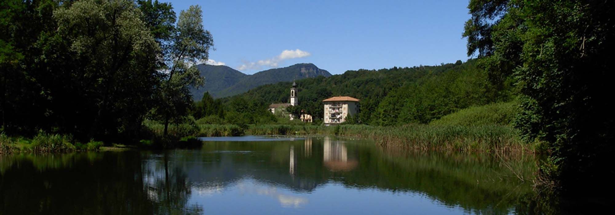
Next a mule track takes you along the lower part of the Legnone Valley, following the path of the river down to Rasa di Varese on the western slopes of Mount Chiusarella. Rasa di Varese is a quiet, picturesque village where we can visit the ancient Church of San Gottardo, the parish church of Santa Maria degli Angeli, and the “Stagno della Tagliata”, a pond recognised locally as a natural monument, which is about half a mile to the south of the village.
DETAILS:
- Duration: 1 hour and 45 minutes
- Distance: 2 km
- Difficulty: medium
- Altitude: 420 mt.
- Starting point: Brinzio, piazza Enrico Riziero Galvaligi
- Arrival point: località Valico delle Pizzelle
- Parking: yes, free
Complete your journey: reach your destination thanks to Trenitalia