The village of Orino is set in the green countryside of Valcuvia on the north-west slopes of Mount Campo dei Fiori at 442 metres. With panoramic views, this peaceful village is far from the busy roads along the valley floor, yet is quick and easy to reach from main roads and from neighbouring villages.
The trail continues on along Via Gorizia and Via Alla Selva Piccola, following the characteristic cobbled roads until you get to the tiny hamlet of “Ronco”, where there is a commemorative plaque to three young soldiers who died on 15 June 1922 when a trench mortar exploded during a military exercise.
The No. 2 trail continues to climb along the east side of the Mezzo Valley until you get to a turning on the left that leads to “Pian delle Noci” after a few hundred yards. By following the “Pian delle Noci” turning downhill you reach “Fonte Gesiola” after just over half a mile. Here we find the ancient spring and an archetypal grotto that was a characterful bar and restaurant until a few years ago but is now closed.
After leaving the left turning to “Pian delle Noci”, the No. 2 trail carries on uphill, becoming gradually steeper and steeper. As the trail makes a right-angle turn to the east, at 820 metres, and starts to cross the western slopes of “Colma” on the maximum gradient, we find a picturesque trail on our right that crosses the wooded northern slopes of Monte Prà Camareè and links up with the No. 10 trail (Velate-Orino) in “Quattro Strade”. After that you are in the Campo dei Fiori Regional Park.
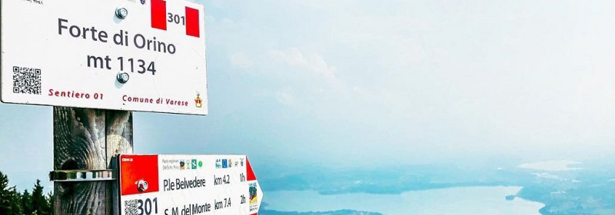
The climb gets steeper and more difficult until you reach a grassy mule track leading to the military road, an old army road, (No. 1 trail/Prima Cappella-Orino Fort) which has several twists and turns before reaching the peak known as the Orino Fort. This military fort was once part of the Cadorna Line, built in the First World War, and now offers breathtaking panoramic views over the alpine foothills, the Piedmontese and Central Alps as well as the western part of the Po Valley and the Varese lakes.
DETAILS:
- Duration: 2 hours and 45 minutes
- Distance: 3 km
- Difficulty: medium difficulty
- Altitude: 697 mt.
- Starting point: Orino, Piazza XI Febbraio
- Arrival point: Forte di Orino
- Parking: yes, free
Complete your journey: reach your destination thanks to Trenitalia